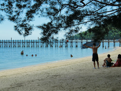
climbing mount kinabalu

our mt kinabalu conquering group of nine - 8 from melbourne and 1 (myself) from s'pore - made it to low's peak, the summit, before 6.00 a.m. on 21 june 2010. the youngest in the group was 26 and the oldest was myself at 62.

in terms of profession/occupation, the group comprises four engineers, one software developer, one doctor, one wedding planner, one marketing researcher and one retiree.
we had begun the second and final part of our assault at 2.00 a.m. quite a number of us had gone without much sleep because of headache, resulting from altitude sickness. breakfast, or supper as they call it, was at an unearthly 1.45 a.m.
all nine of us - four women and five men - shared a dormitory at laban rata. except for two, the rest had left the trekking poles behind so as to free our hands to grasp the damp ropes. it had rained non-stop in the early part of the night.

the eight, being from melbourne, and myself, having been through two winters in melbourne, were adequately prepared for the freezing temperature at low's peak, the highest point on mt kinabalu. each one of us had gloves, beanies, thick woollen socks and at least two layers of clothes. however, the socks did not provide much comfort because they were damp because of the wet shoes.
in kota kinabalu, prior to the climb, we had stayed at the promenade hotel located at the city's waterfront. a mini-bus was arranged to take us on the 2-hour trip to mt kinabalu park where we would stay the night before starting on the climb.

at the park, the group members stayed in three well-furnished and spacious chalets. there was even satellite tv in each of the chalets, so we did not miss out on the telecast of the world cup matches that night.
we met our guides, one of whom doubled as our porter, at kinabalu park. a shuttle bus took us to timpohon gate, one of the two starting points for the climb. we covered the 6km rocky and mountainous trail from timpohon to laban rata, in slightly over 5 hours.

i would list team-work, team-spirit, perseverance, pacing and encouragement and assistance from the guides as factors contributing to our accomplishing the feat.
the two fittest men in the group, paul hii and robert, kept the weaker ones going by relieving them of their loads (backpacks) and staying with them as they laboured along.
edward, 90kg and without much physical training for the climb, was the epitome of grit and determination. he was the slowest in the group and he made the most stops, yet he made it to the top. elaine and kam chan were also remarkable for their perseverance and never-say-die attitude.

we took small steps and followed the path of least resistance. there was no urge to overtake or to stay ahead of other groups. i think the slow and steady pace saved us from severe attitude sickness which afflicted some climbers.
elaine and kamp would have given up if not for the encouragement and assistance provided by their respective guides. the guides literally held their hands and dragged them along.

the unanimous verdict of everyone in the group: it was a once-in-a-lifetime experience but none of us would want to go through it again. we only realised after the climb, the kind of risks we had subjected ourselves to. for the rope climb, both ascent and descent, there was no safety harness and the guide could not be with everyone. the descent put great strain on your knees, ankles and even, your toes.

as i have mentioned in an
earlier posting on mt kinabalu, any reasonably fit person would be able to make it to the top, provided you were not incapacitated by altitude sickness. you might also need steely determination and support and encouragement from your team members and the guides. it really did not help when it rained a lot and you felt cold, tired and hungry.

now that i have accomplished the feat, i am in a position to give some advice and tips. (1) condition yourself for this prolonged strenuous activity. (2) it is not a competition, so go at your own pace. (3) you are responsible for your own safety; don't be rash and impatient. (4) poncho, proper trekking shoes, gloves, warm clothings and headlight are essentials. (5) take small steps and follow the path of least resistance. (6) hydrate yourself - drink enough plain water. (7) carry energy snacks with you. (8) persevere.